- CSS in the News
- Environmental Resource Assessment & Management
Providing Technical Assistance for Reporting Francis Scott Key Bridge Collapse

Following the Francis Scott Key Bridge collapse in March 2024, high-profile news outlet, CNN, contacted NOAA’s Office for Coastal Management seeking ship traffic data and expertise from the Marine Cadastre team. CSS employee owners supporting the Marine Cadastre project (through a subcontract with Lynker) are the team’s data experts and were the most qualified to respond to the request. They provided the most recent vessel traffic (AIS) data available for public consumption for the Baltimore Harbor and Chesapeake Bay. In addition, CSS staff provided technical assistance to help the media understand the data and the information they provide.
AIS data are collected by the U.S. Coast Guard, and transponders are required for most commercial and recreational vessels over a specific weight or length. CNN staff used the data to develop a map that demonstrates ship traffic patterns in the Baltimore Harbor along with the route of the Dali, the large container ship that collided with the bridge support causing the collapse. This information helps visualize the impact to the port that the bridge collapse has and will continue to cause as the recovery effort continues.

For many years, CSS employee owners have processed, managed, and maintained AIS data. While part of the team’s intent to incorporate the data into Marine Cadastre was originally to assist users with conflict avoidance, the team is grateful they could assist with this request.
See More CSS Insights

Contributing to Wind Energy Area Designations
The Bureau of Ocean Energy Management (BOEM) recently announced two Wind Energy Areas (WEAs) in the Gulf of Mexico. The WEAs are located off the coasts of Galveston, Texas, and Lake Charles, Louisiana and have the potential to power nearly three million homes. BOEM collaborated with the National Oceanic and Atmospheric Administration (NOAA) to identify…
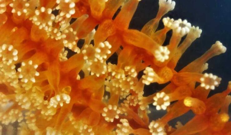
Collecting and Studying Deep-Sea Coral
Three of our staff supporting NOAA’s National Centers for Coastal Ocean Science joined a team of nine other scientists on a 12 day expedition to collect deep-sea coral samples in the Gulf of Mexico.
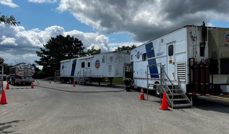
Emergency Response Support for the Republican National Convention
CSS employee owners on contract with the U.S. Environmental Protection Agency’s Portable High-throughput Integrated Laboratory Identification System — a mobile analytical unit known as PHILIS — provided emergency response support for the 2024 Republican National Convention. PHILIS mobile laboratory units are designed to provide onsite analysis of environmental conditions, including air and soil samples, contaminated…