- Uncategorized
- Environmental Resource Assessment & Management
Supporting Wetlands Today and Throughout the Year
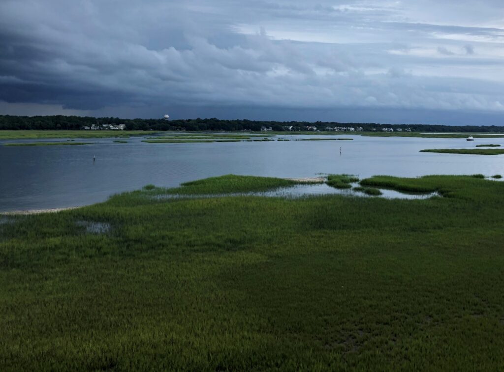
February 2 is World Wetlands Day, a day to celebrate and honor these invaluable ecosystems. Through a variety of projects on several contracts, our employee owners support wetlands throughout the year. Below are some examples of projects that CSS works on to support wetlands and promote the benefits they provide.
- National Wetland Condition Assessment. Our employee owners have supported research in wetland biogeochemistry and ecology for over two decades through our contract with the U.S. Environmental Protection Agency Pacific Ecological Systems Division in Corvallis, Oregon. Much of this work has been associated with National Wetland Condition Assessment as part of the EPA National Aquatic Resources Surveys. CSS staff helped develop field protocols, analyze water samples, and conducted field surveys.
- Field Studies. Through our contract with NOAA’s National Centers for Coastal Ocean Science, we have supported many projects related to wetlands around the country, including monitoring and assessing wetland restoration projects, using unoccupied aircraft systems to monitor wetlands, ecological assessments, economic valuation of wetlands for shoreline protection, and many more. Our scientists work in the field along with NOAA scientists to study and collect data that will be useful to coastal communities and decision-makers.
- National Estuarine Research Reserve System. Our employee owners primarily serve as coastal management technical experts and liaisons between the national estuarine research reserves and NOAA’s Office for Coastal Management (the agency that manages the system in partnership with state agencies, academic institutions, or non-profit organizations). The estuarine reserve system protects nearly 1.4 million acres of estuarine, wetland, riverine, forest, and open water environment.
- Data and Tools. Through the contract with NOAA’s Office for Coastal Management, our staff develop and manage data, tools, and training that help coastal managers understand the benefits of wetlands. These products include Land Cover Data, Sea Level Rise Viewer, Coastal County Snapshots – Wetland Benefits, and the Coastal Flood Exposure Mapper.


See More CSS Insights

New Contract. Same Great Work.
We’re pleased to announce a new small business joint venture with Paul Bechtel & Associates (PB&A), which was awarded a 5-year contract to continue supporting the U.S. Environmental Protection Agency’s (EPA) Office of Pesticide Programs. For 40 years our staff have supported EPA’s Office of Pesticide Programs in the review and evaluation of pesticide data.…
CSS Awarded Five Year Subcontract Supporting the Bureau of Engraving and Printing
For over 22 years, CSS has supported the Bureau of Engraving and Printing (BEP). Originally as a prime contractor, CSS began supporting BEP in 2002. In November 2024, a new prime contractor, Koniag, signed CSS as a major subcontractor, which enabled CSS employee owners to continue providing comprehensive environmental, occupational safety and industrial hygiene support…
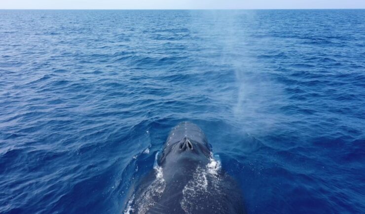
Training Marine Mammal Programs to Use Drones to Collect Dolphin and Whale Respiratory Health Data
CSS employee owner and Marine Mammal Drone Specialist supports NOAA’s National Centers for Coastal Ocean Science (NCCOS) Marine Mammal Health Assessment team with collecting respiratory health data from marine mammals in local waterways. Using specialized drones equipped with petri dishes provides a non-invasive method to collect exhaled breath (i.e. blow) samples from dolphins and whales.…